Quiet, overlooked, and surprisingly rich in solitude, the Yorkshire Wolds Way offers a slower kind of escape. Spanning 79 miles from the Humber Estuary to the North Sea, this is real England — all dry valleys, hidden villages and skies that go on forever. For overseas visitors to the UK and business travellers in need of headspace, it’s a trail worth walking — not for spectacle, but for stillness, finds The European’s John E. Kaye
For overseas visitors to the UK, walking holidays usually mean the drama of the Scottish Highlands, coastal cliffs in Cornwall, or routes like the Pennine Way that have earned a kind of pilgrimage status. But tucked away in East Yorkshire is a National Trail that offers something different — quieter, slower, and in many ways more restorative.
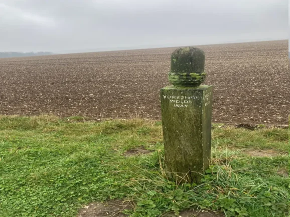
The Yorkshire Wolds Way runs for 79 miles between Hessle Foreshore, near the mighty Humber Bridge, and the pretty seaside town of Filey. It doesn’t boast dramatic views every hour, or a rich pub scene, or much in the way of foot traffic. What it does offer is peace, space, and a mostly quiet walk through gently rolling farmland and old chalk valleys.
This is real England — not the postcard kind, but the everyday kind: dry stone walls, sheep in fields, quiet villages, pub lunches when you can find them, and long hours of countryside silence. For business travellers with a few days to spare or overseas visitors wanting to see more than the obvious, it’s a refreshing break from the curated version of Britain that most tourists are shown.
Getting Started: Hessle to South Cave
This isn’t a trail that’s going to knock your socks off in the opening mile. The first stretch out of Hessle is flat and forgettable, brushing the edge of industrial Hull before gradually shifting into something greener. If you’re not paying attention, it’s easy to miss the signs through the city — we added several miles to an already long 35-mile day that way.
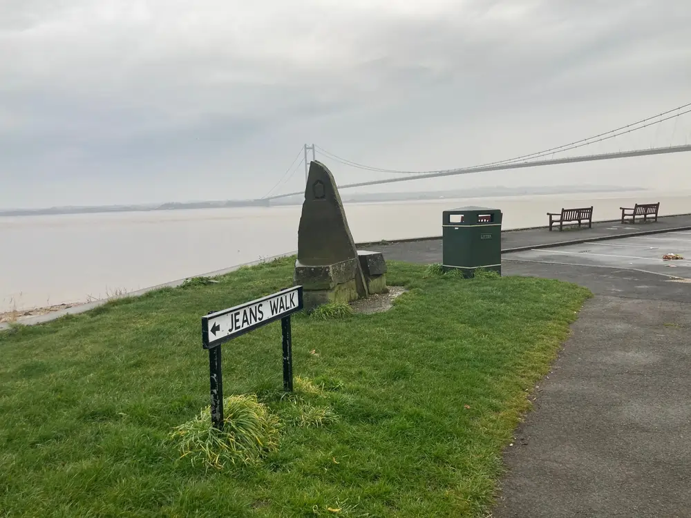
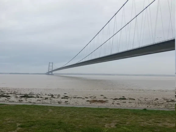
The route officially starts at Hessle Haven, but most walkers begin under the Humber Bridge, where a sculpture marks the National Trail’s start. The first few miles run along the Humber estuary — wide, windswept, and dotted with chalk pebbles and wading birds. You’ll pass through old quarry sites, and the remains of Bronze Age boats were found nearby, preserved in the mud for thousands of years.
Past the village of Welton, the trail begins to climb and settle into its rhythm.
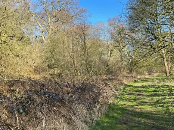
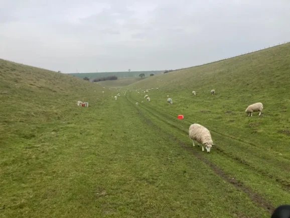
Once you leave Hull behind and step properly into the countryside, the landscape and the walk itself find their pace. This is where the Wolds Way begins to show its character — not dramatic, not wild, but gently immersive. There are long stretches where you won’t see another person. You’re far more likely to be sharing the trail with sheep or cattle — and plenty of both.
A few sections cross fields with bulls, which might not be everyone’s idea of relaxing. You’ll also pass working farms, including piggeries, and if you’re walking through these areas at night — especially during a long day — the sudden flicker of motion-activated lights and the sound of barking dogs can feel oddly theatrical. Not dangerous, just… eerie.
The ground underfoot is generally kind. The trail follows low hills and grassy paths, with only occasional short climbs. It’s not mountainous, and in dry weather it’s very manageable. But in rain, the chalk can turn slick, and grassy slopes become surprisingly treacherous. A pair of walking poles is highly recommended — not just for balance and grip, but for confidence when crossing wet fields full of livestock, especially where cows or bulls are involved.
South Cave to Goodmanham or Market Weighton
You pass Little Wold Vineyard before climbing gently to High Hunsley Beacon and descending into Swin Dale, one of many dry valleys that begin to define the walk. North Newbald, just off the trail, is worth a detour for its pub and Norman church.
The path skirts Market Weighton, passing ancient tumuli and the remains of a Roman amphitheatre. Both Market Weighton and Goodmanham are good options to stop for the night. Goodmanham offers more character — with its microbrewery pub, The Fiddle Drill café, and historical roots dating back to AD 626, when King Edwin of Northumbria converted to Christianity here.
Goodmanham to Millington
This section winds through Londesborough Park, a quiet patch of landscaped estate now open to walkers. Red kites are often visible overhead. You’ll pass the Buddhist retreat at Kilnwick Percy Hall, where tea and calm are served in equal measure, before climbing towards Warren Dale and dropping into Millington, a quiet, pretty village with a decent pub and peaceful accommodation.
Millington to Thixendale (via Fridaythorpe)
This is classic Wolds walking — through valleys like Horse Dale and Holm Dale, and eventually into Fridaythorpe. Here you’ll find Seaways Café, and if you take one recommendation from this entire feature: go there. We hobbled in and were met with proper Yorkshire warmth — tea, full breakfasts, a place to dry out, and not a word of complaint. It was genuinely one of the kindest, most welcome stops on the trail.
From there, the path continues into Thixendale, nestled in a steep-sided valley. It’s arguably the loveliest village on the route. The Cross Keys pub is a walker’s classic, and Robert Fuller’s gallery nearby adds a wonderful local wildlife dimension — think owls and foxes caught on hidden cameras, turned into finely observed art.
Thixendale to Sherburn (and glamping on the trail)
Beyond Thixendale, the trail rises to its highest point (700ft) and drops into Wharram Percy, a deserted medieval village that’s more atmosphere than ruins — but all the more interesting for that.
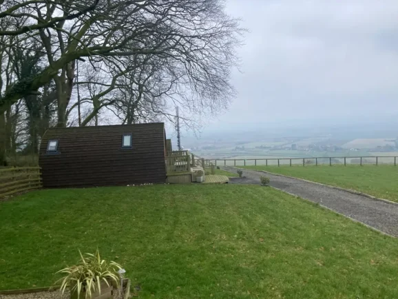
Shortly after, you’ll come across Wolds Walk Glamping, a small site of beautifully crafted pods right on the trail. No detours, no extra miles. Just a proper bed, views that roll on for miles, and a hot shower without leaving the path.
Then it’s up again to Settrington Beacon and down through woodland to Sherburn, a small village with a pub, shop, and bus links.
Sherburn to Filey (and that final mile)
You’re nearly at the sea, but the trail still has a few things to show you. It follows the northern edge of the Wolds past farmland and ancient earthworks. The unmistakable white dome of RAF Staxton Wold, the world’s oldest operational radar station, rise from the fields nearby — a striking contrast to the sleepy pace of the walk.
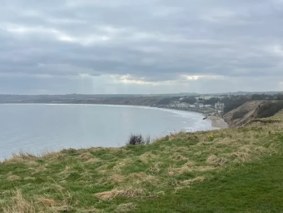
After descending past Stocking Dale and through Muston, you enter Filey — but you’re not done yet. The official end of the Yorkshire Wolds Way is still 1.5 miles away, across town and up a final climb to Filey Brigg.
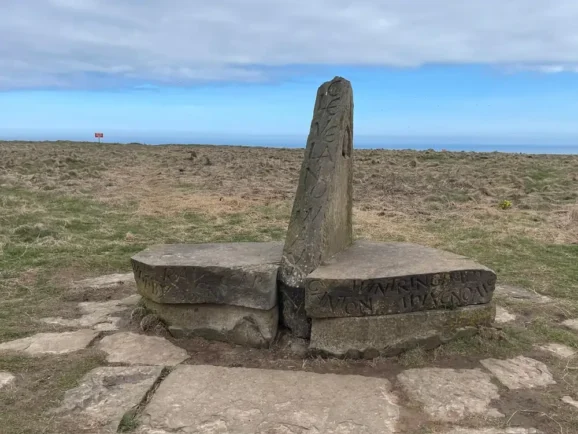
Here, on a headland above the sea, stands a carved acorn sculpture — the official end of the Yorkshire Wolds Way and the start of the Cleveland Way, which continues along the North Yorkshire coast.
It’s a proper ending. Wind in your face. Salt in the air. Boots full of miles. And something in you — whether you came for rest or distance — a little more grounded than before.
How to Walk It
You can walk the trail in 2.5 to 3 days, but only if you’re used to long days with few stops. For most, 4 to 6 days is more realistic and more enjoyable. With limited accommodation directly on the trail, you’ll want to book ahead and plan carefully.
Aim for 12–16 mile days, check for pub and café opening times, and if you can, build in stops at Seaways Café, Wolds Walk Glamping, and Thixendale — not just for convenience, but because they lift the whole experience.
What to Expect
This isn’t a hard trail — until it sometimes is. With a few steep exceptions, the terrain is generally gentle. But the weather, the mud, and the livestock can add complication. Walking poles help. Take food and water every day. Don’t assume you’ll find either easily or without a detour.
The signage in Hull is poor, and missing a turn can cost you time. Use a GPS app or print maps before you go.
Mobile signal is sometimes patchy, especially in the smaller villages.
And don’t forget: the finish line isn’t in Filey. It’s through Filey, up some steps, and another mile and a half to that final sculpture.
Getting There
By Train:
- Hull is the nearest major station to the start at Hessle, with direct trains from London, Manchester, and Leeds.
- Filey (at the end of the route) has its own station with regular services to Scarborough, York, and Hull via TransPennine Express.
- Return trains from Filey to Hull are frequent and inexpensive, making it easy to loop back to your starting point the same day without hassle.
By Car:
- Free and paid parking is apparently available near Hessle Foreshore.
- Filey also has long-stay parking options close to the station and town centre.
- If you’re staying at the Premier Inn Hull West (Hessle), parking is free during your stay, and additional days can be booked through an app. It’s secure, low-cost, and ideal if you’re leaving your car while you walk.
Where to Stay at the Start:
For those travelling from further afield, the Premier Inn Hull West (technically in Hessle) is one of the most convenient places to start. It’s just a few minutes from the Humber Bridge and the trailhead sculpture at Hessle Foreshore. Clean, affordable, and accessible — with good food options nearby — it’s ideal for arriving the night before and setting off fresh the next morning. Look out for the resident peacocks – tame enough to eat from your hand.

Public Transport On Route:
Transport between trail sections is limited, especially in the more rural parts of the Wolds.
- Some walkers pre-book local taxis for pickups and drop-offs in villages such as Thixendale, Fridaythorpe, and Huggate.
- Others use luggage transfer services that include overnight stays and coordination between sections.
- If walking the trail in sections, plan ahead — buses are infrequent, and some routes only run a few times per week.
Fact File: History Along the Yorkshire Wolds Way
- Bronze Age Boats – Discovered near the Humber Foreshore, nearly 4,000 years old.
- Roman Amphitheatre – Near Market Weighton at Hesselskew Farm.
- Iron Age Tumuli – Around Arras Farm and beyond.
- Wharram Percy – Deserted medieval village abandoned in the 15th century.
- Goodmanham – Site of King Edwin’s conversion to Christianity in AD 626.
- Kilnwick Percy Hall – Historic country house now a Buddhist retreat.
- Londesborough Park – Former estate lands once owned by the Duke of Devonshire.
- RAF Staxton Wold – Active radar site since the Napoleonic era.
Fact File: Wildlife to Watch For
- Red Kites – Often spotted near Londesborough and Nunburnholme.
- Buzzards & Kestrels – Common across the high ridges.
- Skylarks – Their song defines the trail in spring and summer.
- Hares & Roe Deer – Occasionally seen darting across farmland.
- Foxes & Owls – Particularly around Thixendale, captured on wildlife cams.
- Wading Birds – Seen along the Humber Foreshore, including curlews and redshanks.
Main image, courtesy 43 Clicks North/Pexels