California rolls out new fire-tracking system after deadly January wildfires

John E. Kaye
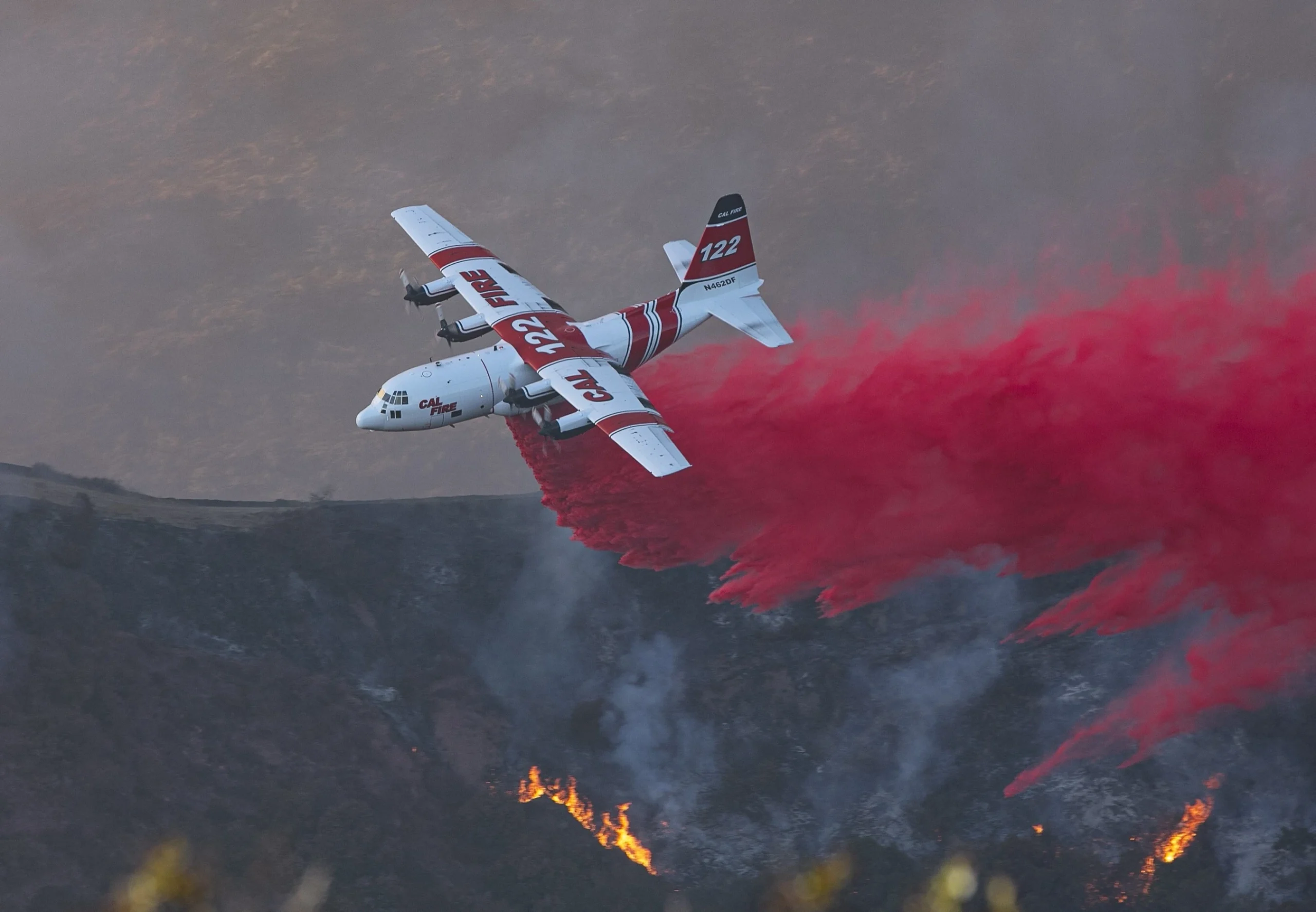
California is overhauling its aerial firefighting systems after wildfires in January killed 30 people and destroyed more than 18,000 buildings across the south of the state
The new platform, called the CAL FIRE Aviation Tracking and Information System (CATIS), replaces ageing software with a real-time cloud-based system aimed at helping crews respond faster and more effectively from the air.
It is being rolled out by CAL FIRE — the state’s main wildfire agency — in partnership with aviation data firm TracPlus. The system is powered by the company’s FireFlyte software and is already used by fire services in Australia and New Zealand.
CAL FIRE says the system will help streamline dispatch and give commanders a clearer picture of what’s happening on the ground and in the air. It is designed to scale with future needs, including advanced analytics and automation.
The January fires were among the worst California has seen in years, with more than 200,000 people forced to evacuate and over 57,000 acres burned. Fierce Santa Ana winds and extreme drought fuelled the blazes, which destroyed entire neighbourhoods in Los Angeles, Ventura and San Diego counties.
Officials say the new platform won’t stop fires from starting, but it should improve how quickly and effectively crews can deal with them once they break out — especially during large-scale events like those seen earlier this year.
CAL FIRE operates one of the largest aerial firefighting fleets in the world, with more than 60 aircraft including air tankers, helicopters and tactical planes. The new system will track each aircraft in real time and provide mission data to help teams coordinate and review their operations.
Todd O’Hara, Chief Marketing and Product Officer at TracPlus, said: “As California faces increasingly complex wildfires, CAL FIRE recognised that modernising their aviation tracking and information systems would directly enhance their ability to protect communities.
“Built on TracPlus’ FireFlyte platform, CATIS transforms how they capture and utilise critical operational data — from real-time aircraft positioning to comprehensive mission reporting — giving their teams the insights needed to deploy resources more effectively during emergency responses.”
The department responds to around 450,000 emergency incidents a year — including an average of 5,600 wildfires — and drops more than 12 million gallons of water and retardant from the air annually.
Photo: Ryan Grothe
RECENT ARTICLES
-
 WPSL targets £16m-plus in global sponsorship drive with five-year SGI partnership
 -
 Dubai office values reportedly double to AED 13.1bn amid supply shortfall
 -
 €60m Lisbon golf-resort scheme tests depth of Portugal’s upper-tier housing demand
 -
 2026 Winter Olympics close in Verona as Norway dominates medal table
 -
 Europe’s leading defence powers launch joint drone and autonomous systems programme
 -
 Euro-zone business activity accelerates as manufacturing returns to expansion
 -
 Deepfake celebrity ads drive new wave of investment scams
 -
 WATCH: Red Bull pilot lands plane on moving freight train in aviation first
 -
 Europe eyes Australia-style social media crackdown for children
 -
 These European hotels have just been named Five-Star in Forbes Travel Guide’s 2026 awards
 -
 McDonald’s Valentine’s ‘McNugget Caviar’ giveaway sells out within minutes
 -
 Europe opens NanoIC pilot line to design the computer chips of the 2030s
 -
 Zanzibar’s tourism boom ‘exposes new investment opportunities beyond hotels’
 -
 Gen Z set to make up 34% of global workforce by 2034, new report says
 -
 The ideas and discoveries reshaping our future: Science Matters Volume 3, out now
 -
 Lasers finally unlock mystery of Charles Darwin’s specimen jars
 -
 Strong ESG records help firms take R&D global, study finds
 -
 European Commission issues new cancer prevention guidance as EU records 2.7m cases in a year
 -
 Artemis II set to carry astronauts around the Moon for first time in 50 years
 -
 Meet the AI-powered robot that can sort, load and run your laundry on its own
 -
 Wingsuit skydivers blast through world’s tallest hotel at 124mph in Dubai stunt
 -
 Centrum Air to launch first European route with Tashkent–Frankfurt flights
 -
 UK organisations still falling short on GDPR compliance, benchmark report finds
 -
 Stanley Johnson appears on Ugandan national television during visit highlighting wildlife and conservation ties
 -
 Anniversary marks first civilian voyage to Antarctica 60 years ago


